Land surveying in Northville is essential for accurate property mapping, boundary determination, and project planning. Professional surveying services provide detailed measurements and data that support real estate transactions, construction projects, and land development. Getting expert help ensures that surveys comply with local regulations and industry standards. This minimizes risks related to boundary disputes or construction errors. Surveyors use advanced equipment and techniques to deliver reliable results. Choosing professional services in Northville helps ensure projects proceed efficiently and with confidence. Accurate land surveying protects property rights and investments.
📏 Accurate Boundary Marking
Surveying precisely marks property boundaries, helping to prevent conflicts with neighbors and clarify ownership. This is critical for buying, selling, or developing land parcels. Accurate boundaries also assist local governments with planning and zoning enforcement. Well-defined property lines reduce legal risks. Reliable marking supports future land use and investment decisions.
🏗️ Project Planning Support
Surveyors provide detailed topographical and site data used for designing buildings, roads, and utilities. This information helps architects and engineers create safe and compliant structures. Surveying also identifies potential site challenges such as slopes or obstructions. This data enables effective project management and reduces costly mistakes. Planning with precise data improves overall project outcomes.
🌿 Environmental Compliance
Land surveying identifies environmentally sensitive areas to protect wetlands, habitats, and flood zones. This helps landowners and developers meet environmental regulations. Surveys ensure projects avoid damaging protected areas or causing unnecessary disruption. Maintaining environmental compliance improves community relations. Surveying supports sustainable and responsible land development.
📝 Legal Documentation
Certified survey reports and maps provide official documentation for property transactions and legal matters. These documents are often required for title insurance, financing, and permits. Professional surveys help resolve disputes by clearly defining land ownership and boundaries. Legal documentation from surveys increases transaction transparency. It protects all parties involved in property deals.
💡 Enhanced Decision Making
Survey data provides critical insights for investors, developers, and landowners. Understanding exact land features and boundaries helps with feasibility studies and risk assessment. This information supports better planning and budgeting. Accurate data reduces unexpected complications during development. Well-informed decisions lead to successful project completion.
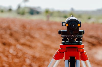
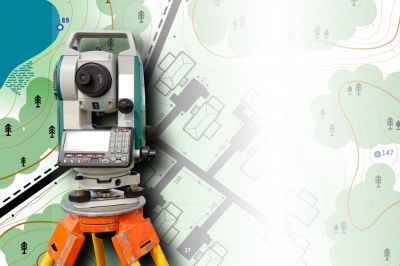
⚙️ Advanced Technology Use
Professional land surveyors utilize cutting-edge equipment like GPS, drones, and laser scanning. These technologies improve survey accuracy and efficiency. Advanced tools enable detailed mapping of complex sites quickly. Technology enhances data collection and reduces human error. Using the latest tools ensures reliable and up-to-date survey results.
🔧 Property Improvement Assistance
Surveying helps identify the best areas for construction, landscaping, and infrastructure upgrades. It guides property enhancements while respecting legal and environmental boundaries. Proper surveying ensures improvements are compliant and maximize land use. This supports long-term property value and functionality. Assistance from experts makes development smoother and more effective.
Fill out the contact form to request land surveying services in Northville today. Secure accurate, professional surveying to support your project from start to finish.