Get Land Surveying in Bayville, NJ
Land surveying services for property owners in Bayville, NJ, help with boundary identification, site planning, and project layout for construction, fencing, or land division.
If you own property in Bayville, NJ, and are considering development, boundary adjustments, or land improvements, understanding your land’s layout is essential. Land surveying services provide precise measurements and detailed property data that can support planning and decision-making for a variety of projects. Whether you're preparing for construction, ensuring property boundaries are clear, or assessing land features, working with experienced local contractors can help you gather the accurate information needed to move forward confidently.
Exploring options for land surveying in Bayville allows property owners to compare different service providers and find the right fit for their specific needs. Local professionals have a deep understanding of the area's land features and regulations, making them well-equipped to handle a range of surveying tasks. Keep reading to learn more about how local contractors can assist with your land-related projects and help you make informed decisions about your property.
- Boundary Surveys - needed when establishing property lines for new construction or resolving disputes in neighborhoods around Bayville, NJ.
- Topographic Surveys - useful for planning site development or grading projects in local residential areas.
- Construction Staking - required to accurately position structures during building or renovation projects in nearby communities.
- ALTA/NSPS Land Title Surveys - essential for commercial property transactions and title insurance in the Bayville area.
- Subdivision Surveys - necessary when dividing land parcels for new residential developments or lot sales in local neighborhoods.
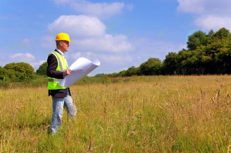

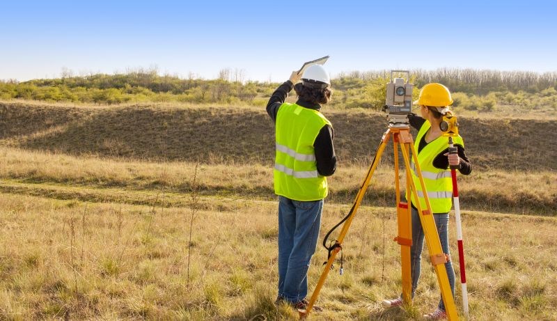
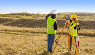
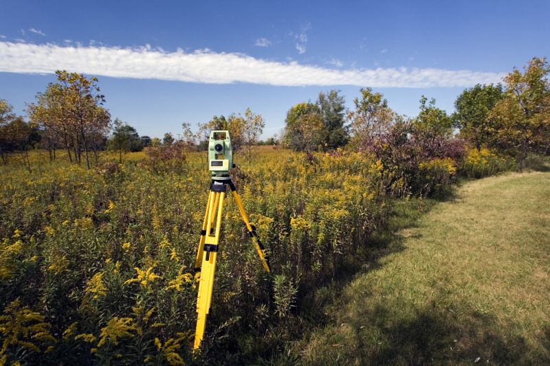
Land surveying services involve measuring and mapping the boundaries, features, and topography of a property. These surveys provide accurate, detailed information about property lines, existing structures, and natural features. This data is essential for planning construction projects, dividing land, or resolving boundary disputes. By working with experienced service providers, homeowners can ensure their property details are precise, helping to prevent future conflicts or legal issues related to property boundaries.
Many property-related problems can be addressed through professional land surveying. For example, if a homeowner plans to build a fence, add a new structure, or expand their property, a survey can confirm the exact boundaries. Surveys are also useful when buying or selling land, ensuring that all parties agree on the property lines. Additionally, land surveys can identify encroachments or overlaps with neighboring properties, helping to resolve disputes before they escalate.
Land surveying services are commonly used for residential, commercial, and agricultural properties. Homeowners with large or irregularly shaped lots often need surveys to accurately mark boundary lines. Those planning additions, renovations, or new constructions on their property also benefit from surveying to ensure compliance with local regulations. Farms and rural properties frequently require land surveys to establish clear boundaries for fencing, crop management, or future development projects. In all cases, professional land surveying helps property owners make informed decisions and avoid costly mistakes.
Engaging with local service providers for land surveying ensures access to experienced professionals familiar with the specific requirements of properties in areas like Bayville, NJ. These experts use precise measurement tools and techniques to produce reliable maps and boundary delineations. Whether it’s confirming property lines before a new construction, resolving boundary disputes, or preparing for land transactions, working with qualified surveyors can provide clarity and confidence. Contacting local contractors for land surveying services is a practical step toward managing property boundaries and planning future projects effectively.
The overview below groups typical Land Surveying projects into broad ranges so you can see how smaller, mid-sized, and larger jobs often compare in Bayville, NJ.
In many markets, a large share of routine jobs stays in the lower and middle ranges, while only a smaller percentage of projects moves into the highest bands when the work is more complex or site conditions are harder than average.
Smaller Land Surveys - Typical costs for basic boundary or property line surveys in Bayville, NJ range from $250 to $600. Many routine projects fall within this middle range, depending on property size and complexity.
Residential Lot Surveys - For larger residential lots or simple topographic surveys, local contractors often charge between $600 and $1,500. These projects are common and usually fall within this moderate cost band.
Commercial or Complex Projects - Larger, more detailed surveys for commercial properties or development sites can start around $2,000 and may reach $5,000 or more. Fewer projects require this level of detail, so costs tend to be higher for specialized work.
Full Property Replacements - Complete boundary re-establishments or property replacements can cost $3,000 to $10,000+, depending on size and complexity. Such projects are less frequent but necessary for significant developments or disputes.
Actual totals will depend on details like access to the work area, the scope of the project, and the materials selected, so use these as general starting points rather than exact figures.
Construction Site Planning - Land surveyors provide precise measurements and boundary data essential for planning construction projects, ensuring proper site layout and compliance with property lines.
Boundary Dispute Resolution - Local contractors use surveying skills to establish property boundaries accurately, helping resolve disputes between neighbors or landowners.
Topographic Mapping - Surveying services include creating detailed maps of land elevations and features, which are vital for landscape design and development planning.
Subdivision Development - Land surveyors assist in dividing large parcels into smaller lots by providing accurate boundary and lot line information for subdivision projects.
Utility and Infrastructure Layout - Surveying professionals help plan the placement of utilities, roads, and drainage systems by providing precise site measurements and layout data.
Environmental and Land Use Planning - Surveying skills support environmental assessments and land use planning by mapping natural features and assessing land characteristics.
When selecting a land surveying service provider in Bayville, NJ, it’s important to consider their experience with projects similar to the one at hand. Homeowners should look for local contractors who have a proven track record of handling properties and terrains comparable to their own. An experienced professional will be familiar with local regulations, common site challenges, and the specific requirements that come with surveying in the area. This familiarity can help ensure that the survey is accurate and meets all necessary standards, reducing the likelihood of issues down the line.
Clear written expectations are essential when comparing land surveying services. Homeowners should seek providers who can offer detailed descriptions of the scope of work, deliverables, and any assumptions or limitations involved in the process. Having this information in writing helps ensure that both parties understand what will be provided and can prevent misunderstandings later. Reputable service providers will be transparent about their methods and what to expect, making it easier to evaluate whether their approach aligns with the project’s needs.
Reputable references and effective communication are key factors to consider when choosing a land surveying professional. Homeowners are encouraged to ask for references from past clients who had similar projects, providing insight into the contractor’s reliability and quality of work. Good communication skills are also vital; a responsive and clear communicator can help clarify project details, answer questions, and keep the process smooth. It’s important to remember that these service providers are there to handle the work, while the site simply connects homeowners with local options to find the right professional for the job.
Property owners in Bayville, NJ use Land Surveying services for practical projects around their homes and businesses. This guide focuses on everyday jobs and straightforward project options.

Land surveying services are often needed for property boundary confirmation, especially when planning new construction or home additions in Bayville, NJ. Property owners may seek these services to ensure accurate property lines before installing fencing, landscaping, or building structures, helping to avoid potential disputes with neighbors. Additionally, land surveys can be essential when purchasing a property, dividing land, or preparing for development projects, providing clarity on the exact dimensions and boundaries of a parcel.
Local contractors offering land surveying can assist property owners in navigating situations such as resolving boundary disagreements, preparing for property line adjustments, or ensuring compliance with local regulations. Whether updating existing boundary records or verifying property limits before construction, these service providers help facilitate smooth project planning. Contacting experienced land surveyors in Bayville can provide the clarity needed for various property-related projects and decisions.
What is land surveying? Land surveying involves measuring and mapping land boundaries, features, and elevations to establish precise property lines and topographical details for various projects.
Why is land surveying important before construction? Accurate land surveys provide essential information about property boundaries and terrain, helping to prevent legal disputes and ensuring construction complies with local regulations.
What types of land surveying services are available? Services can include boundary surveys, topographic surveys, subdivision surveys, and construction staking, depending on the specific needs of a project.
How do land surveyors determine property boundaries? Land surveyors use specialized equipment and reference existing property records to accurately identify and mark property lines and corners.
Can land surveying help with property disputes? Yes, detailed surveys can clarify property boundaries, which can be useful in resolving boundary disputes or clarifying ownership lines.
Property Boundaries Verification - Ensure accurate property lines before starting construction or landscaping projects to avoid disputes.
Land Development Planning - Use survey data to plan new additions or improvements on a property in Bayville, NJ.
Fence and Easement Placement - Determine the correct locations for fences and easements to comply with property regulations.
Subdivision and Lot Division - Assist in dividing larger parcels into smaller lots for development or sale purposes.
If you are thinking about Land Surveying for a property in Bayville, NJ, this guide is meant to help you understand the work, the typical project types, and how different options might fit your plans.
When you are ready, you can use the quote form on this page to share a few details about your project. From there, local pros can review the basics and respond with options that match what you have in mind.