Get Land Surveying in Sonora, CA
Land surveying services help Sonora property owners determine precise boundaries, plan construction projects, and resolve land disputes with the expertise of nearby contractors.
Land surveying services are essential for property owners in Sonora, CA, who are planning construction, land development, or boundary adjustments. Accurate surveys provide critical information for making informed decisions about property lines, building sites, and land divisions. Exploring local options ensures access to experienced service providers familiar with the area’s regulations and terrain, helping property owners avoid potential issues and streamline their projects.
By comparing different local contractors, property owners can find the right professionals to meet their specific needs. Whether for new construction, fencing, or land subdivision, working with experienced surveyors helps ensure precise results that support successful planning and development. Continuing to explore available options can lead to finding trusted service providers equipped to handle the unique requirements of properties in Sonora and surrounding communities.
- Boundary Survey - needed when property lines are unclear or disputed in neighborhoods around Sonora, CA.
- Construction Staking - required to mark precise locations for new buildings or extensions in residential or commercial projects.
- Topographic Survey - useful for planning land development or landscaping in areas with varied terrain near Jamestown, CA.
- ALTA/NSPS Land Title Survey - necessary for property transactions involving large or complex land parcels in the Sonora region.
- Subdivision Survey - essential when dividing land into smaller lots for development or sale in the local community.


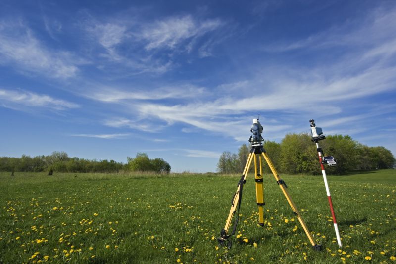
Land surveying services involve measuring and mapping the boundaries, features, and topography of a property. These services typically include establishing property lines, creating detailed maps, and providing accurate measurements that are essential for various property-related projects. Whether planning to build a new structure, divide land, or make improvements, homeowners can rely on land surveyors to produce precise data that helps ensure the project complies with local regulations and avoids potential disputes.
These services are particularly helpful when resolving boundary issues between neighboring properties or clarifying property lines before purchasing or selling land. Land surveys can identify encroachments, easements, or other legal boundaries that might impact property use. For homeowners, having an accurate survey can prevent future conflicts, facilitate clear title transfers, and support planning for renovations or additions, making sure all work is done within legal property limits.
Land surveying is commonly used for residential, commercial, and agricultural properties. Homeowners planning to build fences, extend their homes, or install new structures often need a survey to define exact property boundaries. Landowners involved in subdividing land for sale or development also rely on survey services to create detailed plats and legal descriptions. Additionally, properties with irregular shapes or those near natural features like lakes or hills may require surveys to accurately capture the land’s layout and topography.
By working with experienced local contractors, homeowners can access land surveying services tailored to their specific needs. These professionals use advanced tools and techniques to deliver reliable measurements and detailed maps. Whether for minor boundary clarifications or extensive property development projects, connecting with qualified land surveyors ensures that property boundaries are clearly defined and documented. This step can help prevent legal issues and support smooth property transactions or construction plans.
The overview below groups typical Land Surveying projects into broad ranges so you can see how smaller, mid-sized, and larger jobs often compare in Sonora, CA.
In many markets, a large share of routine jobs stays in the lower and middle ranges, while only a smaller percentage of projects moves into the highest bands when the work is more complex or site conditions are harder than average.
Smaller Property Surveys - routine boundary or topographic surveys for residential lots typically range from $250-$600. Many projects fall within this middle band, though simpler jobs may cost less and more detailed surveys can reach higher prices.
Boundary Line Adjustments - adjusting property lines or resolving encroachments generally cost between $1,000-$3,000, depending on property size and complexity. Most projects are within this range, with larger or disputed boundaries potentially increasing costs.
Large or Complex Projects - extensive land development or subdivision surveys can start around $5,000 and may exceed $20,000 for very detailed or multi-phase projects. These are less common but necessary for major developments or land planning efforts.
Full Land Replacements - complete re-surveys for land replacement or major construction often range from $7,000-$15,000, with higher costs for large, intricate sites. Many large-scale projects fall into the middle of this range, while complex sites may push costs higher.
Actual totals will depend on details like access to the work area, the scope of the project, and the materials selected, so use these as general starting points rather than exact figures.
Construction Site Planning - Land surveyors provide precise measurements and boundary data essential for planning and executing construction projects in Sonora, CA.
Property Boundary Disputes - Local contractors use surveying skills to help resolve boundary disagreements and establish accurate property lines.
Topographic Mapping - Surveying services create detailed maps of terrain features, supporting development and land management efforts nearby.
Subdivision Design - Surveyors assist in dividing large parcels into smaller lots, ensuring compliance with local regulations and accurate lot boundaries.
Environmental Impact Assessments - Land survey data supports environmental evaluations by providing detailed site measurements and topography.
Utility and Infrastructure Planning - Surveying professionals gather data to assist with the planning and installation of utilities and infrastructure projects.

When comparing land surveying service providers in the Sonora, CA area, it’s important to consider their experience with projects similar to what’s needed. Homeowners should look for local contractors who have a proven track record of handling projects comparable in scope and complexity, whether it's boundary surveys, topographic mapping, or construction staking. This experience can provide insights into their familiarity with local terrain, regulations, and potential challenges, helping to ensure the survey work will be accurate and reliable.
Clear, written expectations are essential when evaluating potential service providers. Homeowners should seek professionals who can articulate their process, deliverables, and the scope of work in a straightforward manner. Having detailed, written descriptions helps avoid misunderstandings and ensures everyone is aligned on what the project entails. This clarity can also serve as a basis for comparing different providers and selecting someone who communicates effectively and transparently.
Reputable references and strong communication skills are key indicators of a dependable land surveying contractor. Homeowners are encouraged to ask for references or examples of completed projects to gauge the quality of work and client satisfaction. Additionally, responsive and clear communication throughout the process can make the experience smoother and more predictable. While the site introduces residents to local options, it’s up to homeowners to connect with service providers who demonstrate professionalism, experience, and a commitment to clear, ongoing communication.
Property owners in Sonora, CA use Land Surveying services for practical projects around their homes and businesses. This guide focuses on everyday jobs and straightforward project options.

Land surveying services are often needed for property boundary identification, especially when settling boundary disputes or preparing for construction projects around Sonora, CA. Property owners may seek these services to ensure accurate property lines before installing fences, building additions, or subdividing land. Additionally, surveyors can assist with land development plans, helping to confirm existing property boundaries and topographical features, which can be essential for complying with local regulations and avoiding future legal issues.
Homeowners and landowners in the area might also look for land surveying work when planning to purchase or sell property. Accurate surveys can provide clarity on property limits and help prevent disagreements with neighbors. Whether updating existing boundary lines or establishing new ones for a future project, local contractors skilled in land surveying can provide the precise information needed to move forward confidently with property-related plans.
What is land surveying? Land surveying involves measuring and mapping land boundaries, features, and elevations to establish property lines and support construction or development projects.
Why is land surveying important before building? Land surveying provides accurate property boundaries and site details, helping to prevent legal disputes and ensuring construction complies with local regulations.
What types of land surveying services are available? Services can include boundary surveys, topographic surveys, subdivision surveys, and construction staking, depending on the project needs.
How do local contractors perform land surveys? They use specialized equipment and techniques to gather precise measurements, then create detailed maps and reports for property owners and developers.
How can I find qualified land surveyors in Sonora, CA? Contacting local service providers through a lead generation platform can connect you with experienced land surveyors in the area.
Property Boundary Clarification - Land surveyors can help property owners clearly define property lines for fencing, landscaping, or boundary disputes.
Land Development Planning - Surveying services assist in preparing accurate site plans for new construction or expansion projects on residential or commercial land.
Subdivision and Lot Splitting - Local contractors can provide precise surveys to divide larger parcels into smaller lots for sale or development purposes.
Elevation and Flood Risk Assessment - Surveyors can determine land elevation levels to evaluate flood risks and inform drainage or foundation planning.
If you are thinking about Land Surveying for a property in Sonora, CA, this guide is meant to help you understand the work, the typical project types, and how different options might fit your plans.
When you are ready, you can use the quote form on this page to share a few details about your project. From there, local pros can review the basics and respond with options that match what you have in mind.