Get Land Surveying in Manahawkin, NJ
Land surveying services for property owners in Manahawkin, NJ, help define boundaries, prepare for construction, and resolve property line disputes with experienced local contractors.
Property owners in Manahawkin, NJ, often find that accurate land surveying is a crucial step in planning new construction, home additions, or property boundary adjustments. Ensuring precise measurements and clear property lines can help prevent future disputes and streamline project development. Exploring local service providers allows property owners to compare options and find experienced contractors equipped to handle the specific requirements of projects in the area.
Whether preparing for a new building, subdividing land, or verifying property boundaries, working with qualified local contractors can provide the clarity needed to move forward confidently. Property owners are encouraged to continue exploring available land surveying services to identify professionals who can support their planning needs and help bring their projects to fruition.
- Boundary Surveys - needed when property lines in neighborhoods like Beach Haven need to be accurately marked for development or disputes.
- Topographic Surveys - useful for land development projects in areas with varied terrain, such as near Barnegat Bay.
- Construction Staking - essential when preparing for new builds or renovations on residential or commercial sites in Tuckerton.
- ALTA/NSPS Land Title Surveys - required for property transactions or refinancing in complex land parcels around Stafford Township.
- Subdivision Surveys - necessary when dividing larger parcels into smaller lots for new housing developments in Manahawkin neighborhoods.


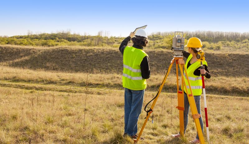
Land surveying services involve the precise measurement and mapping of property boundaries, features, and topography. These surveys are essential for establishing exact property lines, which can prevent disputes with neighbors and ensure that developments or improvements are placed correctly. Professional surveyors use specialized equipment and techniques to gather accurate data about a property’s dimensions, natural features, and existing structures. This information provides a clear understanding of a property’s layout, helping homeowners make informed decisions about construction, fencing, or land division.
One common reason homeowners seek land surveying is to resolve boundary disputes or clarify property lines before buying or selling a property. It can also be necessary when planning new construction, such as building a deck, garage, or extension, to ensure the project complies with local zoning laws and setbacks. Additionally, land surveys are often required for legal documentation or to update property records. These services help identify potential issues early, saving time and avoiding costly conflicts or corrections later in the development process.
Land surveying services are used for a variety of property types, including residential homes, vacant land, farms, and commercial properties. Homeowners with large lots or those planning significant improvements frequently need surveys to confirm boundaries and avoid encroachment issues. Rural properties or parcels with irregular shapes often require detailed topographic surveys to assist in planning proper drainage, landscaping, or future construction. Commercial property owners also rely on land surveys to meet legal requirements and ensure their developments are accurately positioned within property lines.
Understanding when to invest in land surveying can be crucial for homeowners in Manahawkin, NJ, and nearby areas. Whether purchasing a new property, planning renovations, or resolving boundary questions, working with experienced local service providers can help clarify property details and support smooth project execution. By connecting with qualified land surveyors, homeowners can access the expertise needed to address property concerns accurately and efficiently, ensuring their land-related projects proceed with confidence.
The overview below groups typical Land Surveying projects into broad ranges so you can see how smaller, mid-sized, and larger jobs often compare in Manahawkin, NJ.
In many markets, a large share of routine jobs stays in the lower and middle ranges, while only a smaller percentage of projects moves into the highest bands when the work is more complex or site conditions are harder than average.
Small Land Surveys - Typical costs for small-scale surveys, such as boundary or lot line adjustments in Manahawkin, range from $250 to $600. Many routine projects fall within this middle range, with fewer jobs reaching the higher end of the spectrum.
Residential Property Surveys - For standard residential surveys, local contractors often charge between $600 and $1,500. Larger or more detailed surveys, such as for new construction or additions, can cost $1,500 to $3,000+.
Commercial Land Surveys - Commercial projects in the area generally cost from $2,000 to $5,000 or more, depending on the size and complexity of the site. Many projects fall into the $2,000-$4,000 range, with larger, more complex jobs reaching higher prices.
Large or Complex Projects - Extensive surveys for large developments or difficult terrain can exceed $5,000, with costs varying based on scope and site conditions. These projects are less common but are handled by specialized local service providers for detailed mapping and analysis.
Actual totals will depend on details like access to the work area, the scope of the project, and the materials selected, so use these as general starting points rather than exact figures.
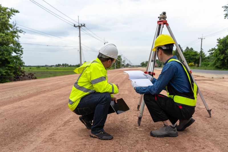
Construction Site Planning - Land surveyors provide detailed measurements and boundary data essential for construction projects, ensuring accurate site layout and planning.
Real Estate Boundary Verification - Real estate professionals rely on survey data to confirm property lines and boundaries before transactions or development.
Topographic Mapping - Topographic surveys involve detailed terrain analysis that uses similar tools and skills as land surveying to assist in site development.
Foundation and Excavation Layouts - Precise measurements from surveyors guide excavation and foundation work, helping to avoid costly errors during construction.
Environmental and Land Use Planning - Surveying services support environmental assessments and land use planning by mapping natural features and property boundaries.
Utility and Infrastructure Layouts - Accurate location data from surveyors assist in planning and installing underground utilities and infrastructure projects.
When comparing land surveying service providers in the Manahawkin, NJ area, it’s important to consider their experience with projects similar to yours. Homeowners should look for local contractors who have a track record of handling land surveys comparable in scope and complexity. This can help ensure that the professional understands the specific requirements and challenges of projects in the region, such as property boundary determinations or topographical surveys. A proven history with similar jobs provides a level of confidence that the service provider is knowledgeable and capable of delivering accurate results.
Clear, written expectations are essential when evaluating potential land surveyors. Homeowners should seek providers who can articulate their process, deliverables, and any assumptions in straightforward terms. Having a detailed scope of work in writing helps prevent misunderstandings and sets a transparent foundation for the project. It’s also advisable to request reputable references from previous clients to verify the quality of the work and the professionalism of the service provider. Speaking with past customers can offer insights into the contractor’s reliability, accuracy, and overall experience.
Effective communication is a key factor in choosing the right land surveying professional. Homeowners should prioritize service providers who are responsive and willing to answer questions thoroughly, ensuring that expectations are aligned from the outset. Good communication fosters a smoother process and helps address any concerns promptly. Since the site introduces homeowners to local options, it’s important to remember that the platform itself does not perform the work. Instead, it connects property owners with qualified local contractors who can handle the surveying services needed for their specific project.
Property owners in Manahawkin, NJ use Land Surveying services for practical projects around their homes and businesses. This guide focuses on everyday jobs and straightforward project options.

Land surveying services are often needed for a variety of common project situations faced by property owners in Manahawkin, NJ. Whether planning to build a new home, add a garage, or install a fence, accurate property measurements and boundary determinations are essential. Local contractors can provide the detailed surveys required to ensure structures are positioned correctly and comply with local regulations, helping property owners avoid potential disputes with neighbors or issues with municipal authorities.
Property owners may also seek land surveying assistance when buying or selling property, to confirm property boundaries before closing, or to resolve boundary disputes. Additionally, those involved in lot subdivision or land development projects often rely on local surveyors to produce precise maps and legal descriptions. Connecting with experienced service providers can help ensure these projects are completed smoothly and in accordance with local standards.
What is land surveying? Land surveying involves measuring and mapping land boundaries, features, and elevations to establish property lines and support construction or development projects.
Why is land surveying important for property owners? Accurate land surveys help property owners understand boundaries, prevent disputes, and ensure compliance with local regulations before making changes to their land.
What types of land surveying services are available? Services can include boundary surveys, topographic surveys, construction staking, and subdivision planning, depending on the project needs.
How do local contractors perform land surveys? Land surveyors use specialized equipment like total stations and GPS technology to gather precise measurements and create detailed maps of the land.
When should I consider hiring a land surveyor? It’s advisable to hire a land surveyor before purchasing property, starting construction, or making land boundary adjustments to ensure accurate information.
Property Boundary Clarification - Local contractors can provide precise land surveys to clearly define property lines, helping owners avoid disputes with neighbors.
Building Project Planning - Land surveying services assist property owners in accurately mapping out construction sites for home additions or new structures.
Land Division and Lot Splitting - Local pros can support property owners in dividing larger parcels into smaller lots for development or sale purposes.
Fence and Landscaping Placement - Land surveys help determine exact locations for fences, gardens, or other landscape features to ensure proper placement.
If you are thinking about Land Surveying for a property in Manahawkin, NJ, this guide is meant to help you understand the work, the typical project types, and how different options might fit your plans.
When you are ready, you can use the quote form on this page to share a few details about your project. From there, local pros can review the basics and respond with options that match what you have in mind.