Get Land Surveying in Rockville, MD
Land surveying services help Rockville property owners accurately define boundaries, prepare for construction or fencing projects, and resolve property line disputes with experienced local contractors.
Property owners in Rockville, MD who are planning renovations, additions, or new constructions often need precise land surveys to ensure their projects start on solid ground. Accurate boundary measurements and topographical data are essential for avoiding disputes, complying with local regulations, and ensuring the safety and success of development efforts. Exploring options among local service providers can help property owners find experienced professionals who understand the unique requirements of the area and can provide reliable surveying services tailored to their specific project needs.
Whether updating property boundaries, preparing for a new build, or assessing land features, connecting with local contractors who specialize in land surveying can make a significant difference. Comparing different providers allows property owners to find qualified experts capable of delivering clear, detailed information necessary for informed planning. Keep reading to discover how local land surveying services can support your property projects in Rockville, MD, with practical, accurate solutions.
- Boundary Surveys - needed when property lines in neighborhoods like Rockville are unclear or disputed.
- Construction Staking - required to accurately mark building locations during new developments or renovations.
- Topographic Surveys - useful for planning site improvements in areas with uneven terrain or existing landscaping.
- ALTA/NSPS Land Title Surveys - essential for commercial property transactions or complex land ownership issues.
- Subdivision Surveys - necessary when dividing large parcels into smaller lots for residential or commercial projects.

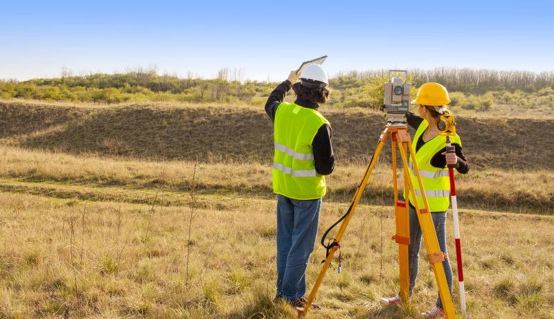

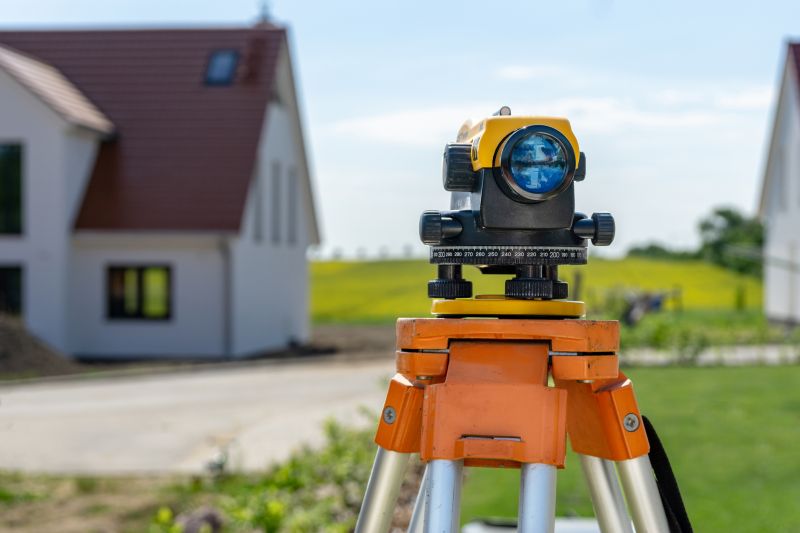
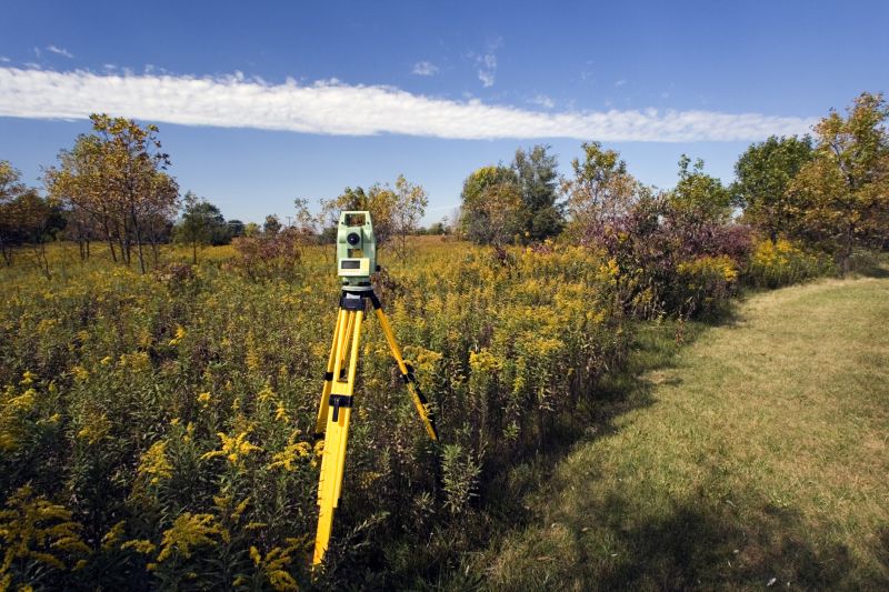
Land surveying services involve measuring and mapping property boundaries, features, and topography to create accurate representations of a parcel of land. These services typically include determining property lines, identifying existing structures, and producing detailed maps or plats. Land surveyors use specialized equipment and techniques to gather precise data, which is essential for various property-related projects. Homeowners in Rockville, MD, and surrounding areas often rely on these services when planning new construction, fencing, or additions, ensuring that all work complies with local regulations and property lines are respected.
One common reason homeowners seek land surveying is to resolve boundary disputes. When property lines are unclear or contested, a professional survey can establish definitive boundaries to prevent future conflicts. Additionally, survey reports are often required during the sale or transfer of property, providing a clear record of the land’s boundaries and features. Land surveying also helps identify potential issues with existing structures, such as encroachments or easements, which could impact future property use or development plans. These services help homeowners make informed decisions and avoid costly legal or construction problems down the line.
Land surveying services are used for a variety of property types, including residential lots, commercial sites, and vacant land. For homeowners, these services are especially useful when planning renovations, installing new fences, or building additions that must stay within property lines. Rural properties and large parcels of land also benefit from detailed topographical surveys, which can assist with drainage planning, landscaping, or future development. Whether working on a small backyard project or a large estate, property owners can find local contractors equipped to handle the specific requirements of their land.
Understanding when to hire a land surveyor can help prevent problems and streamline property projects. If planning to build a new structure, extend an existing one, or sell a property, a survey provides critical information about boundary lines and land features. It can also reveal issues like encroachments or boundary overlaps that may need resolution before proceeding. By connecting with experienced local service providers, homeowners can access the expertise needed to accurately assess their land and ensure their property-related plans are based on reliable data.
The overview below groups typical Land Surveying projects into broad ranges so you can see how smaller, mid-sized, and larger jobs often compare in Rockville, MD.
In many markets, a large share of routine jobs stays in the lower and middle ranges, while only a smaller percentage of projects moves into the highest bands when the work is more complex or site conditions are harder than average.
Smaller Land Surveys - Many routine land surveying jobs in Rockville, MD, fall within the $250-$600 range. These typically include property boundary verification or simple site layout work. Larger, more complex projects can exceed this range, depending on scope and site conditions.
Residential Property Surveys - For residential lots and minor boundary adjustments, local contractors often charge between $600 and $1,200. These projects are common and usually fall into the middle of the pricing spectrum, with fewer jobs reaching higher costs.
Commercial and Larger Projects - Larger commercial land surveys, including site planning and topographic mapping, generally cost between $1,500 and $5,000. These projects tend to be more complex and may involve additional data collection or analysis, leading to higher costs.
Full Property Boundary & Topographic Surveys - Comprehensive surveys for property development or subdivision can range from $2,000 to over $10,000. Many projects land in the middle or upper tiers, especially if the site is large or has challenging terrain, with fewer jobs reaching the highest end of the spectrum.
Actual totals will depend on details like access to the work area, the scope of the project, and the materials selected, so use these as general starting points rather than exact figures.
Construction Site Planning - Land surveyors provide essential measurements and boundary data that help contractors plan and execute construction projects accurately.
Property Boundary Disputes - Land surveying services assist in resolving boundary disagreements by providing precise property lines and legal descriptions.
Topographic Mapping - Surveying professionals create detailed topographic maps used for site development, grading, and planning purposes.
Subdivision Development - Land surveyors facilitate the division of land into plots, ensuring compliance with local regulations and accurate lot boundaries.
Utility and Infrastructure Layout - Surveying experts help in mapping and planning the placement of utilities, roads, and drainage systems within a property.
Environmental and Land Use Planning - Land surveying supports environmental assessments and land use planning by providing detailed site data for local contractors.

When evaluating land surveying service providers in the Rockville, MD area, it’s important to consider their experience with similar projects. Homeowners should look for local contractors who have a proven track record of handling projects comparable in scope and complexity. This background can provide confidence that the surveyor understands the specific requirements and potential challenges of properties in the region. Asking for details about past work can help assess whether a provider’s expertise aligns with the needs of the property, ensuring the survey is accurate and thorough.
Clear written expectations are essential when selecting a land surveying professional. Homeowners should seek service providers who can provide detailed descriptions of the scope of work, deliverables, and any assumptions or limitations upfront. Having this information in writing helps prevent misunderstandings and ensures everyone is aligned on what will be provided. A transparent approach to expectations fosters trust and makes it easier to evaluate whether a particular contractor’s approach matches the project’s requirements.
Reputation and communication are key factors when comparing local contractors for land surveying services. Reputable providers often have references or portfolios that demonstrate their reliability and professionalism. Good communication, including responsiveness and clarity in explanations, allows homeowners to feel confident throughout the process. Service providers who listen carefully to project details and communicate clearly about progress and findings can help ensure the surveying work proceeds smoothly and meets the homeowner’s needs. It’s important to choose a professional who values open dialogue and transparency.
Property owners in Rockville, MD use Land Surveying services for practical projects around their homes and businesses. This guide focuses on everyday jobs and straightforward project options.
Land surveying services are often needed when property owners in Rockville, MD are preparing for a new construction project, such as building an extension or adding a new structure to their property. Accurate property boundaries are essential to ensure that construction stays within legal limits and avoids encroaching on neighboring properties. Additionally, property owners may seek surveying assistance when purchasing land or resolving boundary disputes, helping to clarify property lines and prevent future conflicts.
Homeowners in the area might also look for land surveying services when planning landscaping, installing fencing, or making other modifications that require precise measurements of their property. Whether updating property maps or confirming boundary lines before selling, local contractors can provide the detailed information needed to move projects forward confidently. These services help property owners manage their land effectively and avoid potential legal or development issues.
What is land surveying? Land surveying involves measuring and mapping property boundaries, features, and topography to establish accurate property lines and legal descriptions.
Why is land surveying important before construction? Land surveying provides precise boundary and site data, ensuring construction projects comply with property lines and local regulations.
What types of land surveying services are available? Services include boundary surveys, topographic surveys, subdivision surveys, and site planning assessments performed by local service providers.
How do land surveyors determine property boundaries? They use specialized equipment and methods to measure and analyze land features, helping to establish clear and accurate property lines.
Who can handle land surveying needs in Rockville, MD? Local contractors experienced in land surveying can provide the necessary services for residential, commercial, or public projects.
Property Boundary Verification - Ensures property lines are accurately mapped, helping owners avoid disputes when installing fences or landscaping.
Land Development Planning - Provides precise survey data to support subdivision or construction projects on residential or commercial land.
Building Site Assessment - Assists property owners in evaluating land features and topography before starting construction or renovations.
Easement and Right-of-Way Identification - Helps identify existing easements to prevent conflicts during property improvements or new developments.
If you are thinking about Land Surveying for a property in Rockville, MD, this guide is meant to help you understand the work, the typical project types, and how different options might fit your plans.
When you are ready, you can use the quote form on this page to share a few details about your project. From there, local pros can review the basics and respond with options that match what you have in mind.