Get Land Surveying in Hagerstown, MD
Land surveying services for property owners in Hagerstown, MD, help with boundary identification, site planning, and project layout for renovations, new builds, or land divisions.
Land surveying services are essential for property owners in Hagerstown, MD, who are planning construction projects, boundary adjustments, or land development efforts. Accurate surveys help ensure that property lines are clearly defined, preventing potential disputes and providing a solid foundation for any upcoming work. Whether you're considering building a new structure, subdividing land, or simply verifying property boundaries, understanding your land's precise measurements can make a significant difference in the planning process.
For property owners exploring options in Hagerstown, connecting with experienced local contractors can provide valuable insights and reliable service. Comparing different providers allows you to find the right expertise for your specific needs, ensuring your project proceeds smoothly and with confidence. Keep reading to learn more about how local surveyors can support your property plans and help you make informed decisions.
- Boundary Surveys - needed when property lines need to be clearly defined for land development or ownership disputes in neighborhoods around Hagerstown, MD.
- Construction Staking - required to accurately mark building locations during new construction or remodeling projects in areas like the West End or South End.
- Topographic Surveys - essential for site planning and grading in hilly or uneven terrains near residential developments in Frederick County.
- ALTA/NSPS Land Title Surveys - used for commercial property transactions or legal documentation in busy commercial districts or industrial zones.
- Subdivision Surveys - necessary when dividing larger parcels into smaller lots for residential or commercial use in growing communities around the city.

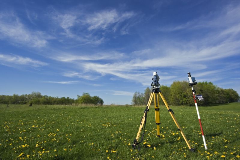

Land surveying services involve precisely measuring and mapping the boundaries, features, and topography of a property. These surveys help establish legal property lines, identify existing structures, and provide detailed information about the land’s features. Whether preparing for a new construction, adding a fence, or dividing land into parcels, accurate surveying ensures that property boundaries are clearly defined and documented. Professional surveyors use specialized tools and techniques to gather data, which is then used to create detailed maps and reports that are essential for planning and legal purposes.
One common reason homeowners seek land surveying services is to resolve boundary disputes or clarify property lines. Disagreements with neighbors over where one property ends can be difficult to settle without an official survey. Additionally, surveys are often required before buying or selling land to verify property boundaries and ensure there are no encroachments. For homeowners planning improvements like building a deck, garage, or driveway, a survey can prevent costly mistakes by confirming where structures can be legally placed. These services are also valuable when updating property records or resolving title issues.
Land surveying is typically used for a variety of property types, including residential lots, farms, commercial properties, and vacant land. Homeowners with large or irregularly shaped lots often benefit from a survey to understand the precise boundaries and features of their property. Rural properties, especially those with multiple parcels or access roads, frequently require detailed surveys for legal and development purposes. Even properties with existing structures can benefit from boundary verification or topographical maps when planning renovations or additions. Local service providers can help determine the specific surveying needs based on the property’s size, location, and intended use.
Overall, land surveying services provide critical information that supports property management, development, and legal clarity. They help prevent future disputes, ensure compliance with local regulations, and facilitate efficient planning for property improvements. Whether for new construction, boundary clarification, or land division, connecting with experienced local contractors can ensure the work is done accurately and reliably. Homeowners in Hagerstown, MD, and nearby areas can find qualified professionals who specialize in land surveying to assist with their specific property needs.
The overview below groups typical Land Surveying projects into broad ranges so you can see how smaller, mid-sized, and larger jobs often compare in Hagerstown, MD.
In many markets, a large share of routine jobs stays in the lower and middle ranges, while only a smaller percentage of projects moves into the highest bands when the work is more complex or site conditions are harder than average.
Smaller Land Surveys - These typically include property boundary surveys or lot line adjustments, with costs ranging from $250-$600 for many smaller jobs. Most routine surveys fall within this middle range, depending on property size and location.
Residential Property Surveys - Surveys for home construction, additions, or renovations usually cost between $1,000 and $2,500. Larger or more complex residential projects can reach $3,000 or more, though many stay within the lower to mid-range.
Commercial Land Surveys - Larger projects such as site planning or boundary mapping for commercial developments often cost from $3,000 to $7,000. These projects tend to fall into higher cost brackets, especially if the site is extensive or has multiple features to survey.
Full Land Development Surveys - Extensive surveys for large-scale developments or infrastructure projects can exceed $10,000, with some complex jobs reaching $20,000 or more. While these are less common, they represent the upper end of typical project costs handled by local contractors.
Actual totals will depend on details like access to the work area, the scope of the project, and the materials selected, so use these as general starting points rather than exact figures.
Construction Site Planning - Land surveyors provide precise measurements and boundary data essential for planning construction projects in Hagerstown and surrounding areas.
Boundary Disputes Resolution - Local contractors use surveying skills to determine property lines and resolve boundary conflicts for homeowners and businesses.
Topographic Mapping - Surveying professionals create detailed maps of terrain features that assist in site development and landscaping projects.
Subdivision Development - Land surveyors assist in dividing larger parcels into smaller lots, ensuring compliance with local zoning and planning regulations.
Utility and Infrastructure Layout - Surveying services help locate existing utilities and plan new infrastructure for roads, pipelines, and electrical systems.
Environmental Impact Assessments - Local service providers conduct surveys to evaluate land features and support environmental planning efforts.
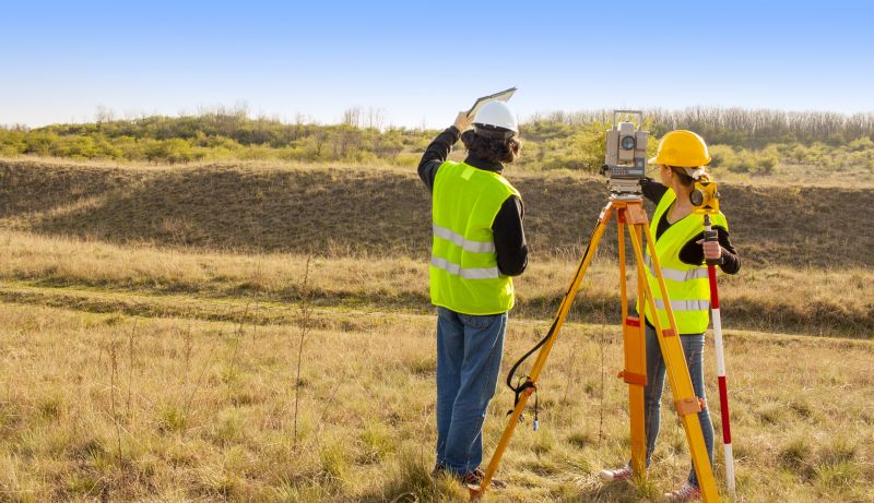
When evaluating land surveying services in the Hagerstown, MD area, it’s important to consider the experience of local contractors with projects similar to your own. An experienced professional will have a clear understanding of the specific requirements and challenges that can arise in your location, whether it’s a residential lot, commercial development, or property boundary clarification. Asking about their background with comparable projects can help ensure they have the practical knowledge needed to deliver accurate and reliable results tailored to your site’s unique conditions.
Clear written expectations are essential when selecting a land surveying provider. A reputable service provider will be able to outline the scope of work, deliverables, and any relevant procedures in a straightforward, detailed manner. This transparency helps prevent misunderstandings and ensures everyone is aligned on what the project involves. When comparing local contractors, it’s valuable to review how they communicate their process and expectations, as this can be a good indicator of their professionalism and commitment to client satisfaction.
Reputable references and effective communication are key factors in choosing a land surveying service. Reliable local pros should be able to provide references from previous clients, especially those who had similar project needs. Good communication throughout the process-whether through prompt responses, clear explanations, or updates-can make a significant difference in how smoothly the project progresses. Remember, this site introduces homeowners to local options capable of handling the work; it does not perform the surveying itself, so taking the time to assess these qualities can help find a trusted professional suited to your project.
Property owners in Hagerstown, MD use Land Surveying services for practical projects around their homes and businesses. This guide focuses on everyday jobs and straightforward project options.


Land surveying services are often needed when property owners in Hagerstown, MD are planning to build new structures, such as home additions or garages, and need precise property boundaries to ensure compliance with local regulations. They may also seek surveying assistance when dividing land for sale or development, helping to establish accurate lot lines and avoid disputes with neighbors. Additionally, property owners might require boundary verification after purchasing a property to confirm existing limits or resolve any uncertainties about property lines.
In other situations, local contractors may recommend land surveying to assist with zoning compliance, especially if property modifications are involved that could impact setback requirements or land use restrictions. Homeowners considering landscape changes or installing fences often turn to surveyors to prevent encroachments and ensure their projects stay within legal boundaries. These services help property owners in Hagerstown manage land-related projects confidently and accurately.
What is land surveying? Land surveying involves measuring and mapping land boundaries, features, and elevations to establish property lines and support construction or development projects.
Why is land surveying important before construction? Land surveying provides accurate boundary and topographical information that helps ensure structures are built within legal property lines and according to plans.
What types of land surveying services are available? Services include boundary surveys, topographic surveys, subdivision surveys, and construction staking, among others, performed by local contractors.
How do land surveys help with property disputes? Accurate land surveys can clarify property boundaries, resolving disputes and providing official records for legal purposes.
Who should I contact for land surveying services in Hagerstown? Local land surveying service providers can be contacted to handle your specific project needs and provide professional assessments.
Property Boundary Clarification - Local contractors can help property owners accurately define lot lines for boundary disputes or future planning.
Construction Planning Support - Land surveyors provide precise measurements to assist with building additions or new construction projects.
Land Division and Subdivision - Service providers can facilitate dividing a large property into smaller parcels for sale or development.
Topographic and Site Assessments - Surveying professionals can evaluate land features to inform landscaping, drainage, or excavation projects.
If you are thinking about Land Surveying for a property in Hagerstown, MD, this guide is meant to help you understand the work, the typical project types, and how different options might fit your plans.
When you are ready, you can use the quote form on this page to share a few details about your project. From there, local pros can review the basics and respond with options that match what you have in mind.